


Microsoft Places
IMDF & Places – Which Way is Up? Balancing Geographic Context with User-Centric Indoor Mapping


Introduction
When you walk into your office, do you ever think about which way it’s facing (north or south) or how it’s aligned with the world outside when trying to locate a workspace?
I suspect not.
For most of us, displaying our office in relation to a geographic map might be useful when we’re trying to get there, but once inside the office, we navigate based on what we can see in front of us: staircases, lifts, any signage on the walls.
This is why, when it comes to indoor mapping for a regular office space, presenting an indoor floor plan in relation to its external geography doesn’t always make sense.
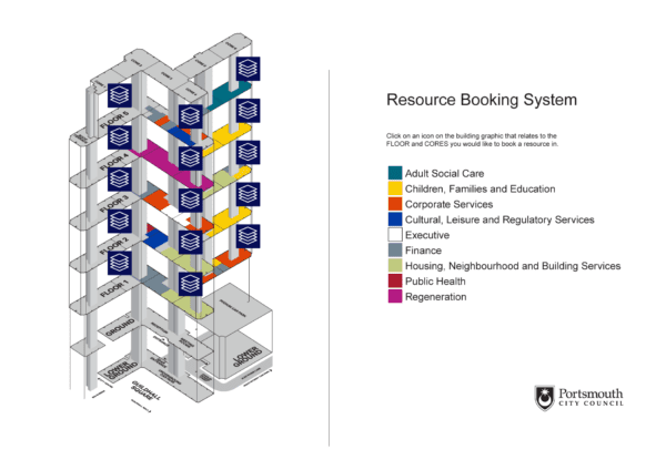
Organisations that have looked at Microsoft Places to date may have been surprised by how their office spaces are depicted using Apple’s Indoor Mapping Data Format (IMDF) standard.
This article explores how IMDF mapping conventions can impact the UX in Microsoft Places, and why you might elect to choose an alternative approach to presenting your workspace maps that prioritises a ‘Heads Up’, entrance-oriented view over strict geographic accuracy.
What Does an IMDF Floor Plan Look Like in Microsoft Places?
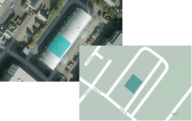
The example below shows the Essential Portishead office floor plan. As you can see, it sits at a jaunty angle!
To the casual observer, the rationale for this orientation isn’t clear.
But, when we view the underlying code for the map – say using https://geojson.tools/ – which allows the inclusion of custom layers that include a satellite view and a road map layer, you’ll see that the orientation marries up with the underlying geography.
However, this raises the question of balance: should we prioritise geographic context simply because IMDF allows it, or should we design maps that serve the end user’s experience, even if that means adjusting the orientation?
Geographic Orientation vs. User-Centric Display
In a large-scale environment like a shopping mall or airport, orienting your indoor map in accordance with ‘outside geography’ can be helpful: North Car Park, South Mall Entrance, etc. I get that.
But imposing geographic context onto an office map is not always necessary, as navigating this space is done according to what’s inside the building and in relation to what my typical starting point might be.
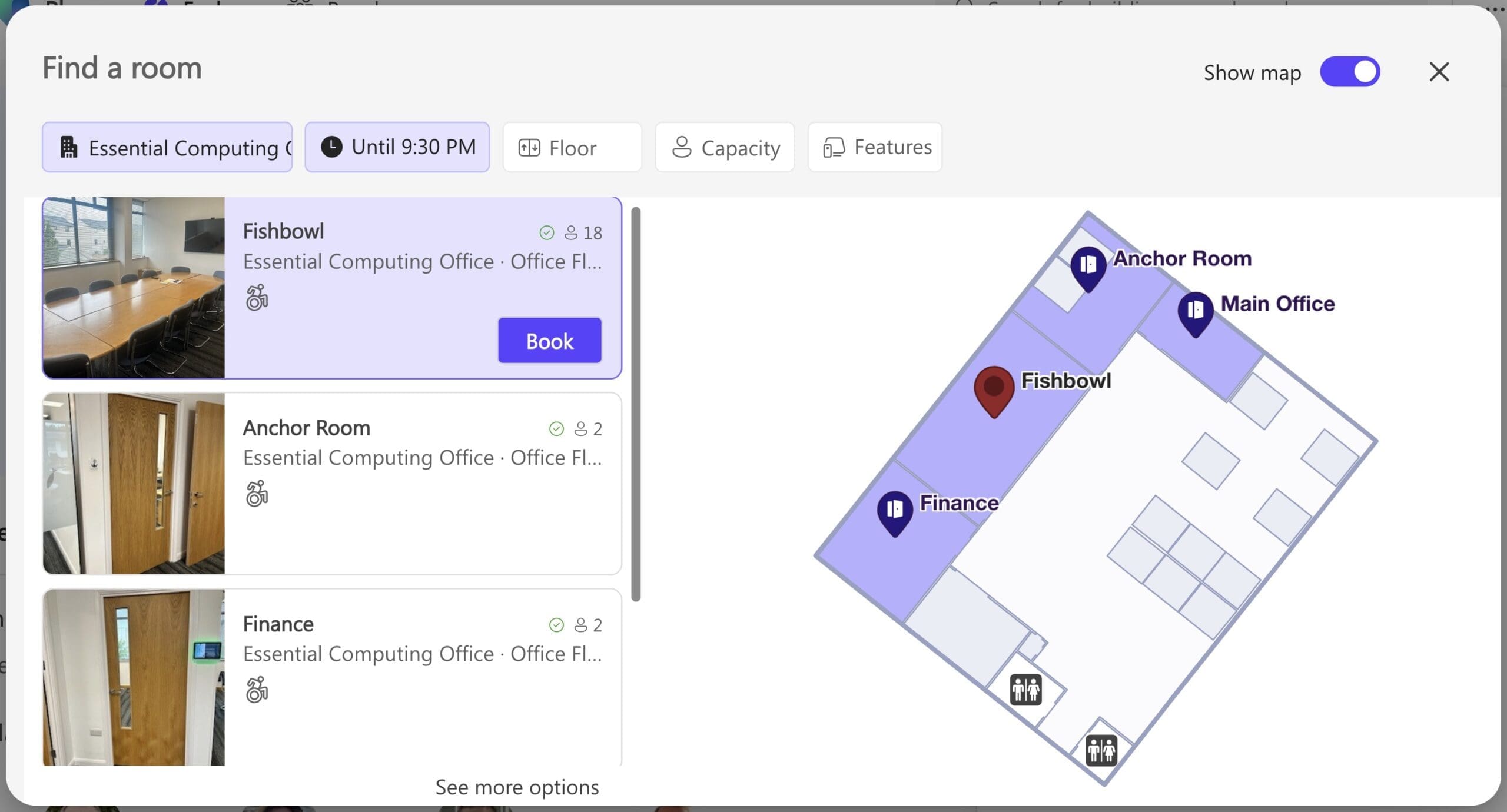
For example, below is an alternative representation of our Portishead office.
As you can see, the entrance is shown at the bottom of the plan, and it is clear where the bookable workspaces are in relation to the entrance.

This approach aligns with how we naturally navigate space. If the entrance is shown at the bottom, users don’t have to mentally reorient themselves; ‘left’ on the map is ‘left’ in real life, and so on.
This setup makes navigation easier, particularly for newcomers or those unfamiliar with the building layout.
You can read more about the HUD approach in this article on best practices for floor plan creation.
Can You Change Floor Plan Orientation in Microsoft Places?
Yes! The good news is that the end user can manually rotate their map view within Microsoft Places and get a 3D view (well, an isometric view to be exact).
- On Windows, right-click and drag
- On Mac, hold the Control key and use your mouse to rotate.
This user-controlled map movement allows more flexibility in how maps are experienced – meaning orientation is no longer a fixed constraint for the viewer.
And, if you want to have the default orientation of your office maps to be aligned according to a ‘heads up’ display, you simply need to skip the step in IMDF mapping platforms like Pointr or MappedIn that let you rotate your building outline to match its orientation on a global map.
We always give our customers the option to orient their office plans to achieve the best UX when creating IMDF files.
Conclusion
Microsoft Places and the IMDF standard are opening new doors for how we visualise and navigate indoor environments, but the ultimate focus should always be on the end user.
After all, the goal is to make sure users know exactly where they’re going when they’re inside the office.
Although Places now supports manual user-driven view rotation, the default orientation is still based on the coordinates and orientation in the IMDF file. So, choosing the right default layout still matters — whether geographic or a entrance-first heads up display (HUD).
In the future, with a published API, Microsoft Places maps might also include:
- More Orientation Information: By showing an underlying map or more details as an overlay, users can better understand why their office is oriented in a certain way by default.
- Styling Options: The ability to customise colours, themes, icons and and other visual elements – e.g., to match your company branding or office decor. This is very limited at present – see this article on icons in Places floor plans for the latest information.
We will watch with interest as Places evolves.